
Satellite heat detections
Hot spots picked up by satellites, with how long ago each was seen and how far away it is.
NASA FIRMS · worldwideEmberWize gathers satellite heat detections, fire perimeters, weather alerts, power outages, air quality and more for any address. See what's happening nearby at a glance, then check the official sources that matter.
Linux, Android and Windows in early access. A web version is coming soon, and iOS is planned.

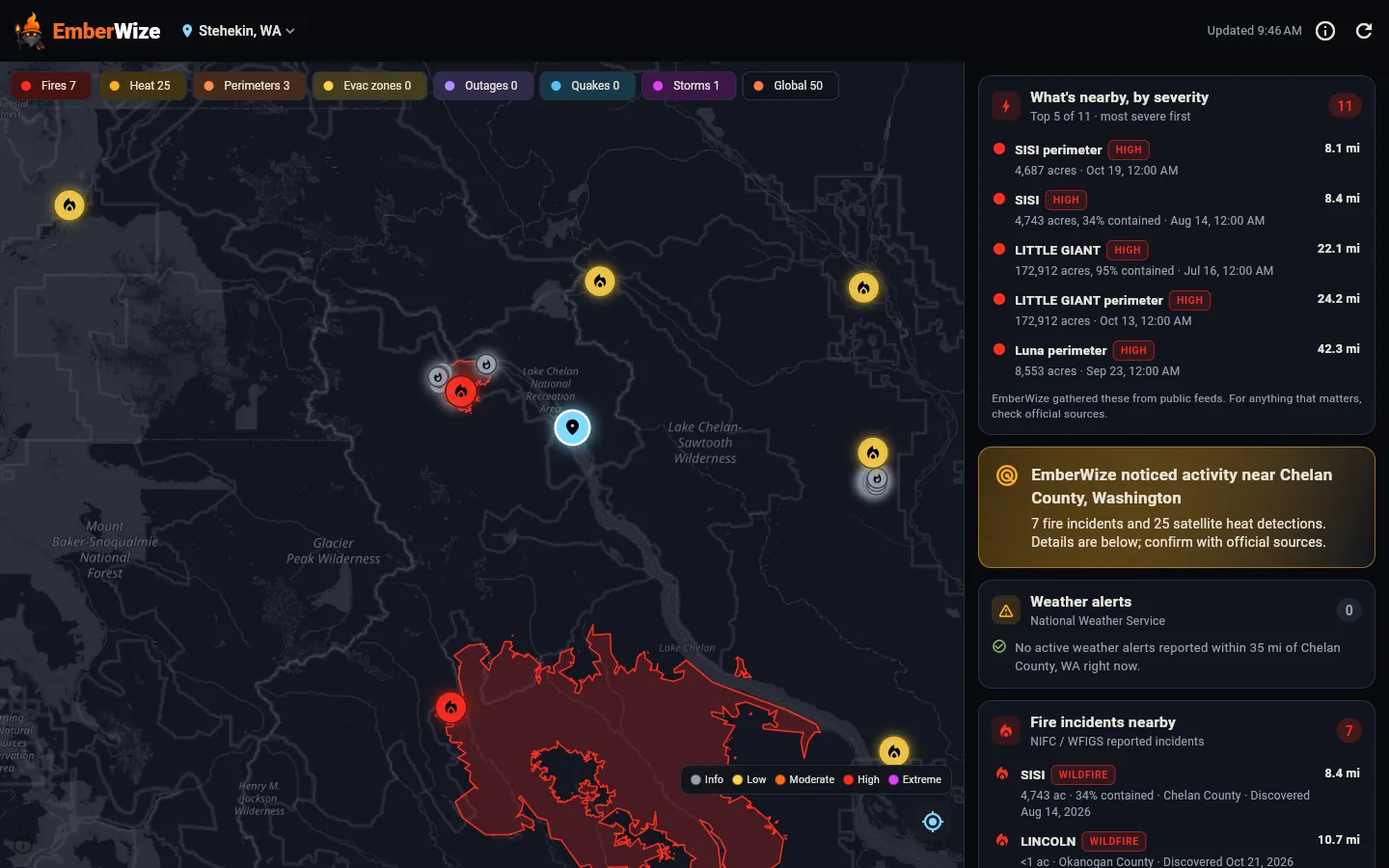
Pick an address and EmberWize pulls the latest from trusted public sources, sorts it by distance and severity, and puts it on one map.
Hot spots picked up by satellites, with how long ago each was seen and how far away it is.
NASA FIRMS · worldwideReported wildfires with size and containment, plus mapped fire boundaries you can tap for details.
NIFC / WFIGS · USActive red flag warnings and other weather alerts for the area, in plain language.
National Weather Service · USCurrent wind conditions and nearby air quality readings, so smoke and fire weather are easy to spot.
Reported outages near the address, shown alongside everything else on the map.
Recent earthquakes and major storm systems, because fire isn't the only thing worth watching.
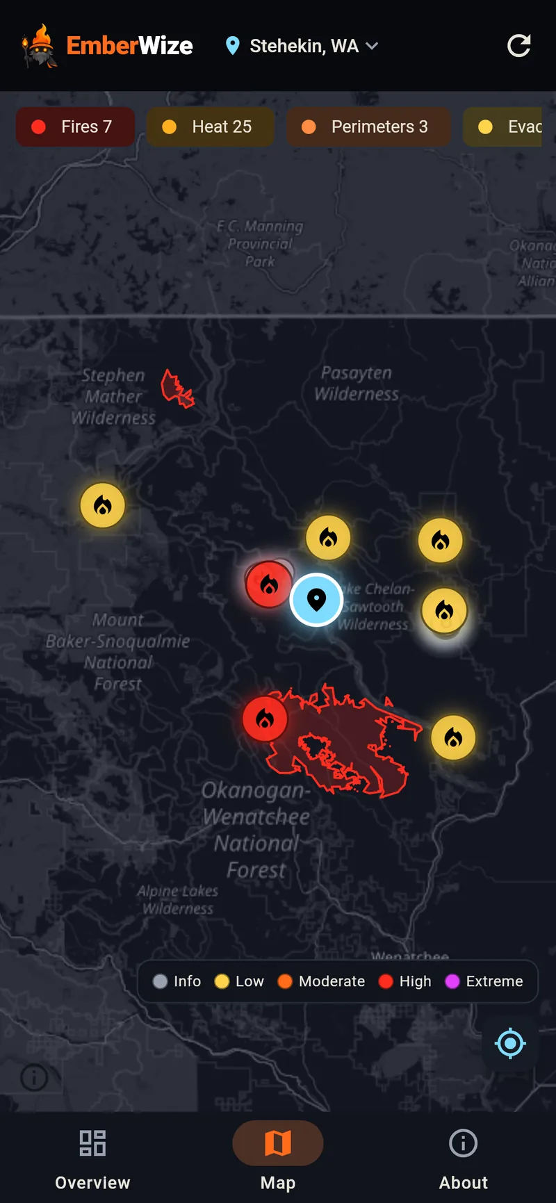
Every event on a single dark map with a clear severity scale and layer toggles to show only what you need.
A short list of the most important things near you, most severe first, with distance and the time of each update.
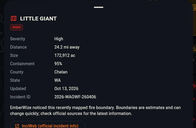
Each fire, perimeter and alert opens a clear summary: severity, distance, size, containment, when it was last updated, and the official source it came from, linked whenever the source provides a page.
Satellite heat detections cover the whole planet. Some feeds, like US fire incidents and National Weather Service alerts, only cover certain places. When a source doesn't cover your location, EmberWize tells you plainly instead of showing an empty panel.
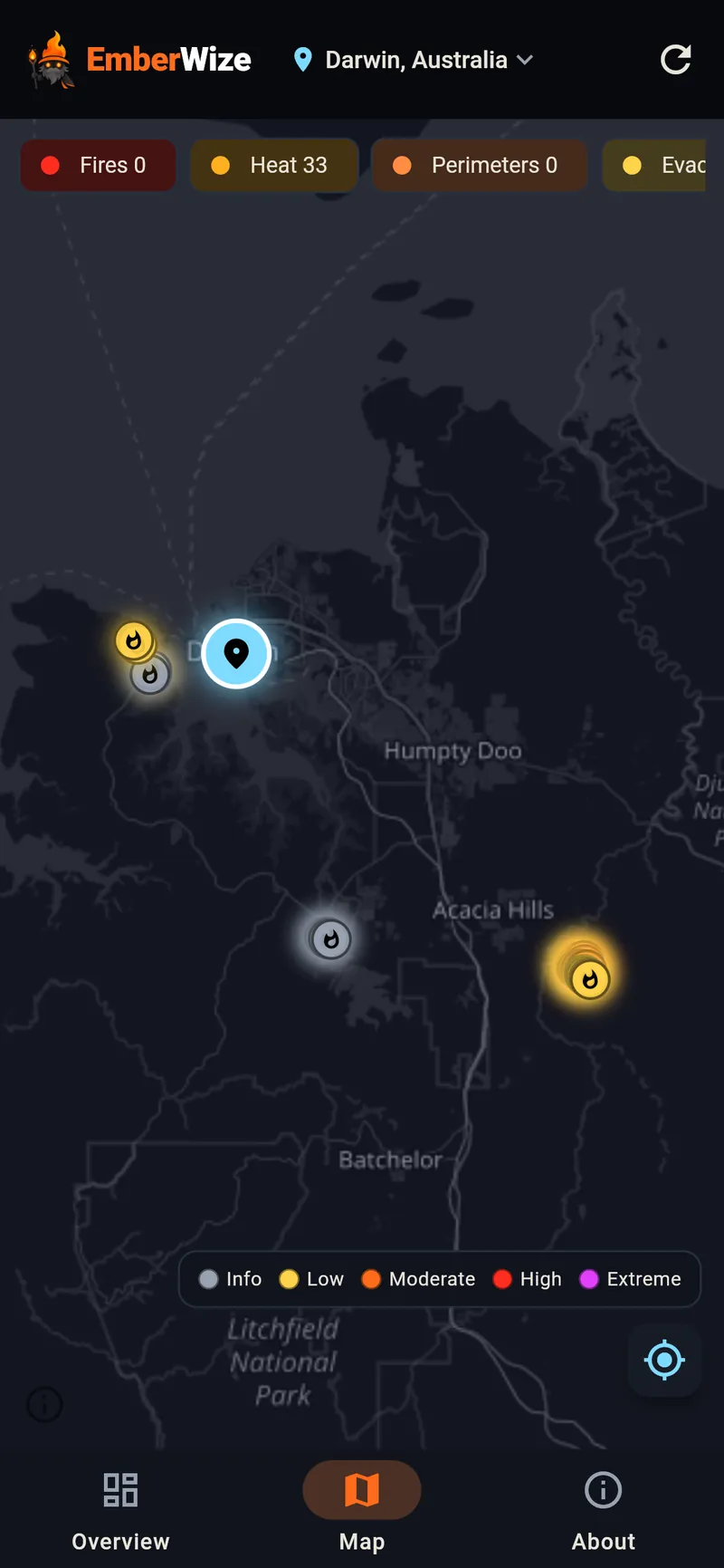
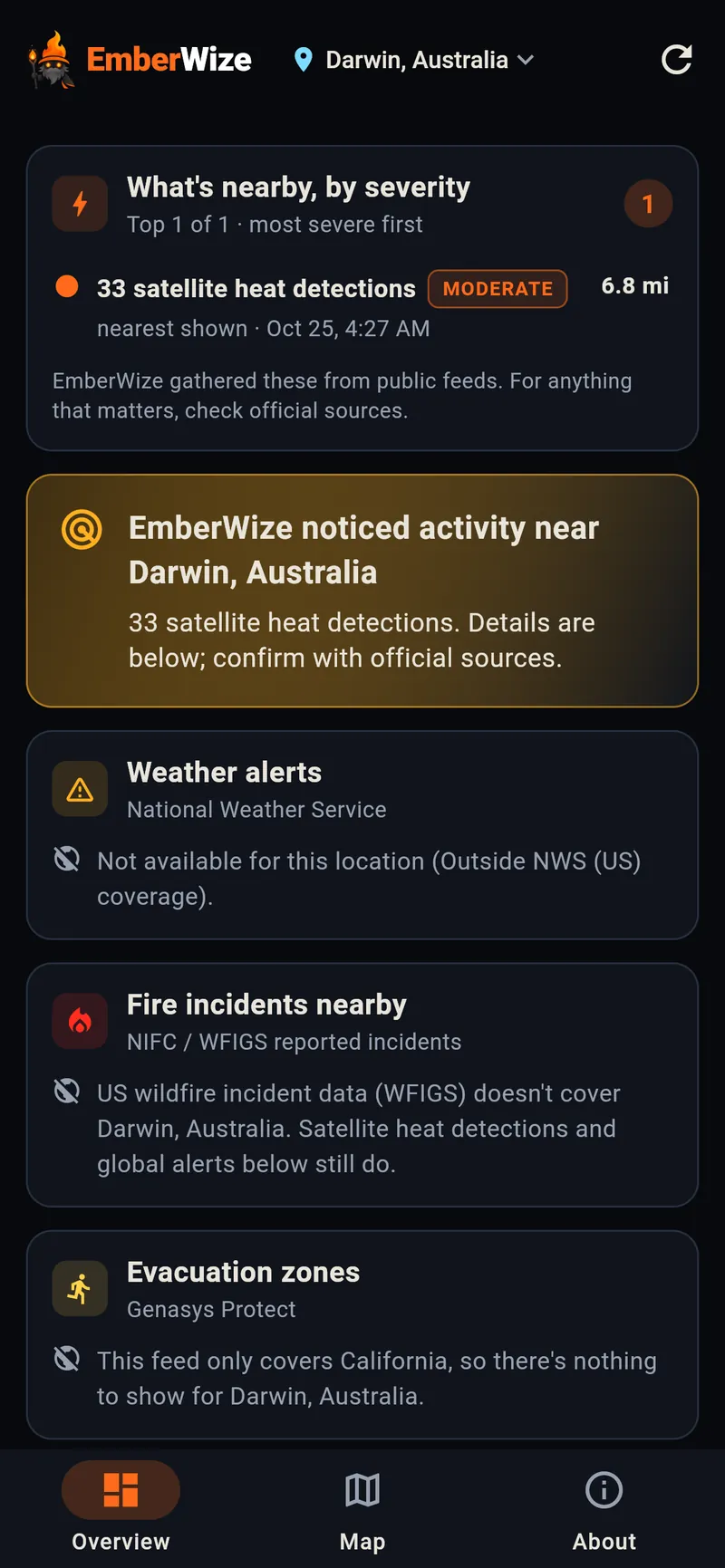
Your home, a family member's place, a cabin or anywhere you're headed.
Fires, heat detections, alerts, outages and more, sorted by severity and distance on one map.
Follow the links to the agencies in charge, and always do what your local officials tell you.
EmberWize was field-tested through the 2026 California fire season. It runs as a Linux and Windows desktop app and on Android today, in early access. A web version is coming soon, and iOS is on the way.

In the public version of EmberWize, the places you pick are saved on your own device. There's no account. To show what's nearby, the app sends the coordinates of the place you're viewing with each request. Our server uses them to build your view, then keeps only a rounded area of about 10 km in short-lived memory caches. Our server logs record your IP address and the page requested, but never coordinates, place names or searches.
EmberWize gathers public feeds in one place to help you stay aware. It is not an official emergency alert or warning service, and public data can be delayed, incomplete or wrong.
Always follow official evacuation orders from local authorities, sign up for your county's emergency alerts, and call 911 in an emergency.
No. EmberWize is an information aid that brings public feeds together so they're easier to follow. It doesn't replace official alerts. Follow evacuation orders from local authorities and call 911 in an emergency.
From public sources, including NASA FIRMS for satellite heat detections, NIFC and WFIGS for US fire incidents and perimeters, and the National Weather Service for US weather and red flag alerts, plus public feeds for wind, power outages, air quality, earthquakes and storms. Every item names its source.
Yes, for satellite heat detections, which cover the whole world. Some sources, like US fire incidents and National Weather Service alerts, only cover the US. EmberWize tells you clearly when a source doesn't cover the place you're looking at.
Each source updates on its own schedule, and satellites only pass over a few times a day. EmberWize shows when items were detected or last updated, whenever the source gives a time, so you can judge how fresh they are.
In the public version, the places you choose are saved on your device and there's no account. The app sends the coordinates of the place you're viewing with each request. Our server uses them to build your view and caches results only by a rounded area (about 10 km) in memory. Address searches are passed from our server to OpenStreetMap's Nominatim geocoder. Our logs record IP addresses but never coordinates, place names or searches. The privacy policy has the details.
Linux desktop, Windows and Android are in early access. A web version is coming soon, and iOS is planned.
Email us at contact@probablyworks.studio and tell us which device you'd like to use. We'll be in touch.
We're opening early access a few people at a time. Send us a note and we'll get you set up.